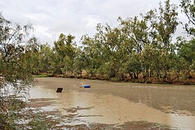
| Moonie River | |
|---|---|
 Moonie River at Nindigully | |
Location of the Moonie River mouth in New South Wales | |
| Location | |
| Country | Australia |
| States | Queensland, New South Wales |
| Region | Southern Downs, Orana |
| Physical characteristics | |
| Source | Braemar State Forest, |
| • location | near Tara, Queensland |
| • coordinates | 27°19′59″S 150°43′32″E / 27.33306°S 150.72556°E |
| • elevation | 347 m (1,138 ft) |
| Mouth | confluence with the Barwon River |
• location | near Mogil Mogil, north of Collarenebri New South Wales |
• coordinates | 29°18′46″S 148°42′43″E / 29.31278°S 148.71194°E |
• elevation | 149 m (489 ft) |
| Length | 542 km (337 mi) |
| Basin size | 14,812 km2 (5,719 sq mi) |
| Discharge | |
| • average | 6 m3/s (210 cu ft/s) |
| Basin features | |
| River system | Barwon River catchment, Murray–Darling basin |
| Reservoir | Thallon Weir |
| [1] | |
The Moonie River (Mooni River) is a river in Shire of Balonne, Queensland and Walgett Shire, New South Wales, both in Australia.[2][3] It is a perennial river of the Barwon catchment within the Murray–Darling basin.
- ^ "Map of Moonie River". Bonzle Digital Atlas of Australia. Retrieved 10 February 2013.
- ^ "Moonie River – watercourse in the Balonne Shire (entry 22673)". Queensland Place Names. Queensland Government. Retrieved 22 May 2019.
- ^ "Mooni River". Geographical Names Register (GNR) of NSW. Geographical Names Board of New South Wales. Retrieved 22 May 2019.
