| Moores Creek National Battlefield | |
|---|---|
 The reconstructed bridge at Moores Creek | |
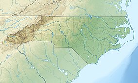
| Location | Pender County, North Carolina, United States |
| Nearest city | Wilmington, North Carolina |
| Coordinates | 34°27′29.6″N 78°06′37.1″W / 34.458222°N 78.110306°W |
| Area | 88 acres (36 ha)[1] |
| Established | June 2, 1926[2] |
| Visitors | 48,406 (in 2005) |
| Governing body | National Park Service |
| Website | Moores Creek National Battlefield |
Moore's Creek National Military Park | |
| Nearest city | Wilmington, North Carolina |
| Area | 44.3 acres (17.9 ha) |
| Built | 1776 |
| NRHP reference No. | 66000070[3] (original) 86003649[3] (increase) |
| Significant dates | |
| Added to NRHP | October 15, 1966 |
| Boundary increase | February 13, 1987 |
Moores Creek National Battlefield is a battlefield managed by the U.S. National Park Service. The park commemorates the 1776 victory of a thousand patriots over about eight hundred loyalists at Moore's Creek. The battle dashed the hopes of British provincial governor Josiah Martin for regaining control of North Carolina for the Crown. The loyalist defeat simultaneously ended British plans for an invasionary force to land in Brunswick Town. The Second Continental Congress voted to declare independence from the British on July 4, 1776, shortly after the battle; which took place in the Wilmington area near Currie in Pender County in southeastern North Carolina. The national military park was established on June 2, 1926, and was redesignated as a national battlefield on September 8, 1980.
- ^ "Listing of acreage – December 31, 2020" (XLSX). Land Resource Division, National Park Service. Retrieved August 15, 2021. (National Park Service Acreage Reports)
- ^ "Park Anniversaries". Retrieved August 13, 2021.
- ^ a b "National Register Information System". National Register of Historic Places. National Park Service. July 9, 2010.

