Morris, Connecticut | |
|---|---|
| Town of Morris | |
 Morris Community Hall | |
| Coordinates: 41°41′38″N 73°12′38″W / 41.69389°N 73.21056°W | |
| Country | |
| U.S. state | |
| County | Litchfield |
| Region | Northwest Hills |
| Settled 1723 | Incorporated 1859 |
| Government | |
| • Type | Selectman-town meeting |
| • First selectman | Tom Weik (R) |
| • Selectman | Erica Dorsett-Mathews (R) |
| • Selectman | Vincent Aiello (D) |
| Area | |
• Total | 18.7 sq mi (48.5 km2) |
| • Land | 17.3 sq mi (44.9 km2) |
| • Water | 1.4 sq mi (3.6 km2) |
| Elevation | 994 ft (303 m) |
| Population (2020) | |
• Total | 2,256 |
| • Density | 120/sq mi (47/km2) |
| Time zone | UTC−5 (Eastern) |
| • Summer (DST) | UTC−4 (Eastern) |
| ZIP code | 06763 |
| Area code(s) | 860/959 |
| FIPS code | 09-49460 |
| GNIS feature ID | 0213465 |
| Website | www |
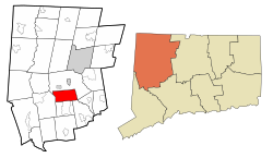
Morris is a town in Litchfield County, Connecticut, United States. The population was 2,256 at the 2020 census.[1] The town is part of the Northwest Hills Planning Region.
Europeans first began to settle the area that became Morris circa 1723. Originally part of the town of Litchfield, it was called the South Farms because of its location 5 miles (8 km) south of the center. Designated a separate Congregational parish in 1767 and incorporated as a town in 1859, it was named after native son James Morris, a Yale graduate, Revolutionary War officer, and founder of one of the first co-educational secondary schools in the nation.
Morris lies in rolling hill country of woods, wetlands, fields and ponds. It also encompasses much of Bantam Lake, originally called the Great Pond, which covers approximately 947 acres (383 ha) and is the largest natural lake in the state. The traditional Town of Morris seal features the pine on Lone Tree Hill, which overlooks the lake. Morris is home to one of the oldest state parks in Connecticut, as well as to one of the newest.
The area's transition from 18th-century settlement to semi-rural community in the 2000s is the story of many Connecticut towns and much of New England. At first, farming barely made families self-sufficient, but in the 1800s, agriculture evolved into a business. Then, over the next 150 years, competition, rising costs and increasing regulation made it less sustainable, despite economies and innovation. In the early 1900s, local water mills, manufactories and other small businesses encountered similar challenges and gave way to industry in nearby Waterbury, Torrington and beyond.
By the 1970s and 1980s, the area was still largely rural, but residents' occupations had grown more diverse. Today, the farming tradition continues even as residents engage in a range of professions, businesses and arts locally and in the wider region. A number of second home owners come from the metro New York area. In addition to the two state parks and Bantam Lake, the 4,000-acre (1,600 ha) White Memorial Conservation Center offers a range of opportunities for outdoor sports and recreation. Camp Washington is a spiritual retreat operated by the Episcopal Diocese of Connecticut.
Morris center looks like a typical small New England village, with a white Congregational church, a school, and town hall. Interspersed with fields and woods, a mix of Early American and newer homes strings out loosely along the town's roads. Children attend the local James Morris elementary school and regional Wamogo High School, a U.S. Department of Education school of excellence. Perhaps counter-intuitively, Morris also holds a Buddhist temple, as well as a Jewish cemetery from the early 1900s.
- ^ "Census - Geography Profile: Morris town, Litchfield County, Connecticut". United States Census Bureau. Retrieved December 17, 2021.


