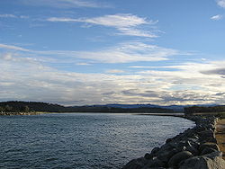
| Moruya River | |
|---|---|
 Moruya River looking upstream from the breakwater on the northern head of the river. | |
 | |
| Location | |
| Country | Australia |
| State | New South Wales |
| Region | South East Corner (IBRA), South Coast |
| Local government area | Eurobodalla |
| Town | Moruya |
| Physical characteristics | |
| Source confluence | Deua River |
| • location | near Kiora |
| • elevation | 22 m (72 ft) |
| Mouth | Tasman Sea, South Pacific Ocean |
| Length | 19 km (12 mi) |
| Basin size | 1,424 km2 (550 sq mi) |
| [1][2] | |
The Moruya River is an open and trained mature wave dominated barrier estuary[3] or tidal river[1] is located in the South Coast region of New South Wales, Australia. In its upper freshwater reaches, the river is known as the Deua River.
- ^ a b "Moruya River". Geographical Names Register (GNR) of NSW. Geographical Names Board of New South Wales. Retrieved 26 May 2013.
- ^ "Map of Moruya River, NSW". Bonzle Digital Atlas of Australia. Retrieved 26 May 2013.
- ^ Roy, P. S; Williams, R. J; Jones, A. R; Yassini, I; et al. (2001). "Structure and Function of South-east Australian Estuaries". Estuarine, Coastal and Shelf Science. 53 (3): 351–384. Bibcode:2001ECSS...53..351R. doi:10.1006/ecss.2001.0796.