| Mount Barney | |
|---|---|
 Mount Barney | |
| Highest point | |
| Elevation | 1,359 m (4,459 ft) |
| Listing | Mountains in Australia |
| Coordinates | 28°17′S 152°42′E / 28.283°S 152.700°E |
| Geography | |
| Location | Queensland, Australia |
| Peaks | West Peak (1359), East Peak (1354), North Pinnacle (1221), Leaning Peak, Isolated Peak, Toms Tum, Midget Peak, Barrabool Peak |
| Parent range | McPherson Range |
| Geology | |
| Rock age | 24 million years |
| Mountain type | Shield volcano |
| Climbing | |
| First ascent | 3 August 1828 by Captain Patrick Logan[1] |
| Easiest route | Peasants Ridge (South Ridge) |
| Normal route | South (Peasants) Ridge, Mezzanine Ridge, Lions Ridge, South East Ridge, Mid South East Ridge, Logans Ridge, Rocky Creek, North Ridge, Northeast Ridge, Eagles Ridge, Short Leaning Route, Long Leaning Route, Midgets Route, Savages Ridge |
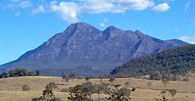
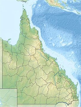
Mount Barney is a mountain within the Scenic Rim Region in south-east Queensland, Australia.[1] It lies approximately 130 kilometres (81 mi) south-west of Brisbane, not far from the Queensland - New South Wales border, and forms part of the McPherson Range. It is a popular destination for bushwalkers and campers. Mount Barney is the sixth or seventh highest mountain in Queensland and is often regarded as one of the most impressive parts of the Scenic Rim. The mountain consists of two main peaks, (East Peak and the slightly higher West Peak), and smaller subsidiary peaks. East Peak is probably the most popular destination for bushwalkers.
The closest town is Rathdowney. Mount Barney is surrounded by other mountains including Mount Ballow, Mount May, Mount Ernest, Mount Maroon and Mount Lindesay. Logan River has its headwaters on the mountain.
- ^ a b "Mount Barney – mountain (entry 40972)". Queensland Place Names. Queensland Government. Retrieved 18 February 2014.
