| Mount Bongao | |
|---|---|
| Bud Bongao | |
| Highest point | |
| Elevation | 342 m (1,122 ft)[1] |
| Prominence | 342 m (1,122 ft) |
| Coordinates | 5°01′07″N 119°44′52″E / 5.01861°N 119.74778°E[1] |
| Naming | |
| Native name | Bud Bongao (Sama) |
| Geography | |
| Country | Philippines |
| Region | Bangsamoro Autonomous Region in Muslim Mindanao |
| Province | Tawi-Tawi |
| City/municipality | Bongao |
| Climbing | |
| Easiest route | Barangay Pasiagan [1] |
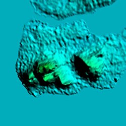
Mount Bongao (famously known as Bud Bongao) is a mountain located on Bongao Island in the province of Tawi-Tawi. It is a mountain formed with six limestone pillars that serves as its six peaks. It is the Philippines' southernmost peak.[2]
Bud Bongao is inside the Bongao Peak Eco-Tourism Park that was inaugurated on July 3, 2017.[3] It is a 250-hectare forest that is one of the last remaining moist forests in the Sulu Archipelago.[4]
The mountain is of spiritual and traditional importance to the indigenous Sama Dilaut people.[5] The mountain is also considered sacred where it is believed that two Islamic preachers[6] who were direct followers of Karim ul-Makhdum, are buried under what is called Tampat Rocks,[4] although the site was already sacred even before Islam arrived. Karim ul-Makhdum brought Islam to the Philippines in the year 1380.[7]
- ^ a b c Malicdem, Ervin (7 June 2017). "Bud Bongao: Trail Data, Peaks and Elevation". 2017 Tawi-Tawi Mapping Expedition: 2–3. doi:10.13140/RG.2.2.10845.92647. Retrieved 16 October 2017.
- ^ Lasco, Gideon. "Beyond Apo: Seven great hiking destinations in Mindanao". ABS-CBN News. Retrieved 2020-08-08.
- ^ "ARMM spent P56 million to boost Bongao Peak tourism". Bureau of Public Information, ARMM Government. 5 July 2017. Archived from the original on 17 October 2017. Retrieved 16 October 2017.
- ^ a b Yan, Gregg (28 April 2014). "Bud Bongao: The sacred mountain of Tawi-Tawi". Rappler. Retrieved 16 October 2017.
- ^ WWF-Philippines 2012-2013 Annual Report (PDF).
- ^ Cite error: The named reference
schadow1was invoked but never defined (see the help page). - ^ Jannaral, Julmunir (8 November 2016). "ARMM commemorates 636th Sheikh Karimul Makhdum Day". Manila Times. Retrieved 16 October 2017.


