| Mount Carleton Provincial Park Parc provincial du Mont-Carlton (French) | |
|---|---|
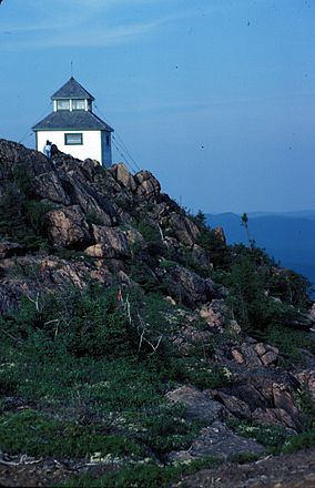
 Fire-spotting hut on Mount Carleton | |
 | |
| Location | Mount Carleton, New Brunswick, Canada |
| Nearest city | Saint-Quentin |
| Coordinates | 47°22′42″N 66°52′30″W / 47.37833°N 66.87500°W |
| Area | 174 square kilometres (67 sq mi) |
| Established | 1970 (provincial park as of 2008) |
| Visitors | 26,373 (in 2009[1]) |
| Governing body | Government of New Brunswick |
 | |
Mount Carleton Provincial Park, established in 1970, is the largest provincial park in the Province of New Brunswick, Canada. It encompasses 174 square kilometres (67 sq mi) in the remote highlands of north-central New Brunswick. The park is a lesser-known gem of the Atlantic Canadian wilderness.[citation needed] Some outdoor enthusiasts[which?] refer to it as the "Algonquin of New Brunswick."
- ^ New Brunswick Department of Tourism & Parks New Brunswick Tourism Indicators Summary Report 2009 , April 2010