| Mount Colah Sydney, New South Wales | |||||||||||||||
|---|---|---|---|---|---|---|---|---|---|---|---|---|---|---|---|
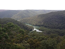
 View of Bobbin Head from the Kalkari Visitor Center | |||||||||||||||
 | |||||||||||||||
| Population | 7,816 (2021 census)[1] | ||||||||||||||
| Postcode(s) | 2079 | ||||||||||||||
| Elevation | 206 m (676 ft) | ||||||||||||||
| Location | 24 km (15 mi) north of Sydney | ||||||||||||||
| LGA(s) | Hornsby Shire | ||||||||||||||
| State electorate(s) | Hornsby | ||||||||||||||
| Federal division(s) | Berowra | ||||||||||||||
| |||||||||||||||
Mount Colah is an outer suburb of Northern Sydney, in the state of New South Wales, Australia 24 kilometres north of the Sydney central business district, in the local government area of Hornsby Shire.
Mount Colah is 5 km north of Hornsby, the nearest major town centre. It is one of the most northerly suburbs of Sydney and is where the "Welcome to Sydney" sign is located. Mount Colah is the second highest suburb in Sydney by elevation. Considered one of Sydney's leafier suburbs, streets are clustered around the Pacific Highway. Mount Colah is bordered to the east by the Ku-ring-gai Chase National Park.
Mount Colah varies in altitude from 68 m to about 206-217 m above sea level.[2][3]
- ^ Australian Bureau of Statistics (28 June 2022). "Mount Colah (State Suburb)". 2021 Census QuickStats. Retrieved 26 September 2024.
- ^ "Map of Mount Colah in New South Wales". Bonzle Digital Atlas of Australia.
- ^ "Mount Colah NSW". exploroz.com.