Mount Dennis | |
|---|---|
Neighbourhood | |
 Weston Road south of Eglinton Ave. W. | |
 | |
| Coordinates: 43°41′31.14″N 79°30′22.37″W / 43.6919833°N 79.5062139°W | |
| Country | |
| Province | |
| City | Toronto |
| Established | 1850 (York Township) |
| Urbanized | 1950s |
| Government | |
| • MP | Ahmed Hussen (York South—Weston) |
| • MPP | Michael Ford (York South—Weston) |
| • Councillor | Frances Nunziata (Ward 11 York South-Weston) |
| Population (2016[1]) | |
| • Total | 62,620 |
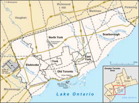
Mount Dennis is a neighbourhood in Toronto, Ontario, Canada. It was initially an urban area within the former township of York. Primarily located along Eglinton Avenue between the Humber River and the Kitchener commuter rail line, the neighbourhood was best known for Kodak Heights, once a major film manufacturing facility owned and operated by the Eastman Kodak Company.[2] According to the 2016 Toronto Ward 11 Census, 62,620 residents are in the area, with a median age of 39.3 as of 2016, and a population growth of over 0.4% as of 2016. 24, 895 households are in Ward 11, and 230 net new households were built in 2016. A total of 31,125 of 62,620 are immigrant populations as of 2016. Unemployment rate is 9.5% in Ward 11 as of 2016, with an average household income of $66,447 and is much lower than Toronto's average of $102,721 as of 2016. Average rent price is $940/month as of 2016's census as well.
- ^ "2016 Ward 11 Census" (PDF). Toronto Clerks Office. 2016. Retrieved 2 June 2018.
- ^ Cite error: The named reference
GlobeAndMail2012-11-23was invoked but never defined (see the help page).
