| Mount Gareloi | |
|---|---|
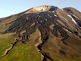
 Summit of the volcano | |
| Highest point | |
| Elevation | 5,161 ft (1,573 m)[1] |
| Prominence | 5,161 ft (1,573 m)[1] |
| Listing |
|
| Coordinates | 51°47′18″N 178°47′39″W / 51.78833°N 178.79417°W[1] |
| Geography | |
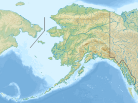
| Location | Gareloi Island, Alaska, U.S. |
| Parent range | Aleutian Islands |
| Geology | |
| Rock age | Holocene-Pleistocene |
| Mountain type | Stratovolcano |
| Volcanic arc | Aleutian Arc |
| Last eruption | August 1989 |
Mount Gareloi, or Gareloi Volcano, is a stratovolcano in the Aleutian Islands of Alaska, United States, about 1,259 miles (2,026 km) from Anchorage. Gareloi is located on Gareloi Island, and comprises most of its land mass. The island also has two small glaciers which protrude to the northwest and southeast.[2]
The volcano is 6 miles (10 km) by 5 miles (8 km) at its base, possessing two summits. The southern crater is far greater in size, 984 feet (300 m) wide with fumaroles, which can be attributed to edifice failure in the southern wall, while Gareloi's northern crater is enclosed.
- ^ a b c "Alaska & Hawaii P1500s - the Ultras". Peaklist.org. Retrieved 2013-01-31.
- ^ Alaska Volcano Observatory, Volcano Information -- Gareloi, Retrieved Dec. 16, 2022.
