| Mount Hachimantai | |
|---|---|
| 八幡平 | |
 Hachimantai Plateau | |
| Highest point | |
| Elevation | 1,613 m (5,292 ft) |
| Coordinates | 39°57′28″N 140°51′15″E / 39.95778°N 140.85417°E |
| Geography | |
| Parent range | Ōu Mountains |
| Geology | |
| Mountain type | Stratovolcano |
| Volcanic arc/belt | Nasu Volcanic Zone |
| Last eruption | 5350 BCE |
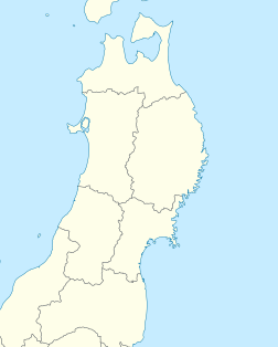
Mount Hachimantai (八幡平, Hachimantai) is the highest peak of a group of stratovolcanos distributed around the Hachimantai plateau in the Ōu Mountains in northern Honshū, Japan. This volcanic plateau is part of the Nasu Volcanic Zone and straddles the border between the Iwate Prefecture and Akita Prefecture. The volcano is listed as one of the 100 Famous Japanese Mountains, and forms part of the Towada-Hachimantai National Park.[1]
- ^ Campbell, Allen; Nobel, David S (1993). Japan: An Illustrated Encyclopedia. Kodansha. p. 484. ISBN 406205938X.
