| Mount Mariveles | |
|---|---|
Mount Mariveles with Mount Limay to its right as seen from the entrance of Manila Bay. Corregidor island is at the foreground right. | |
| Highest point | |
| Elevation | 1,398 m (4,587 ft)[1][2] |
| Prominence | 1,256 m (4,121 ft) |
| Listing | Potentially active volcano |
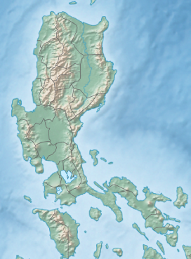
| Coordinates | 14°31′26″N 120°27′50″E / 14.52389°N 120.46389°E |
| Geography | |
 | |
| Country | Philippines |
| Region | Central Luzon |
| Province | Bataan |
| Parent range | Zambales Mountains |
| Topo map | PCGS-2511 |
| Geology | |
| Mountain type | Stratovolcano-Caldera complex[2] |
| Volcanic arc | Luzon Volcanic Arc |
| Last eruption | 2050 BC |
Mount Mariveles is a dormant stratovolcano and the highest point in the province of Bataan in the Philippines. Mariveles and the adjacent Mount Natib comprise 80.9 percent of the total land area of the province.[3] The mountain and adjacent cones lie opposite the city of Manila across Manila Bay, providing a beautiful[editorializing] setting for the sunsets seen from the city.
- ^ "Mariveles". Philippine Institute of Volcanology and Seismology. Archived from the original on 5 October 2011. Retrieved 21 March 2019.
- ^ a b "Mariveles". Global Volcanism Program. Smithsonian Institution.
- ^ Redpen (2008-01-24). "Bataan Mountains". MyBataan.com. Retrieved on 2011-09-15.


