| Mount McLoughlin | |
|---|---|
| Alwilamchaldis, Mayakax, Kesh yainatat | |
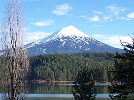
 Mount McLoughlin from across Willow Lake | |
| Highest point | |
| Elevation | 9,493 ft (2,893 m) NAVD 88 |
| Listing | Oregon county high points |
| Coordinates | 42°26′40″N 122°18′56″W / 42.444472472°N 122.315620131°W[1] |
| Geography | |
 | |
| Location | Jackson County, Oregon, U.S. |
| Parent range | Cascade Range |
| Topo map | USGS Mount McLoughlin |
| Geology | |
| Rock age | Less than 700,000 years |
| Mountain type | Stratovolcano[2] |
| Volcanic arc | Cascade Volcanic Arc |
| Last eruption | About 30,000 years ago[2] |
| Climbing | |
| Easiest route | Trail hike[3] |
Mount McLoughlin is a dormant steep-sided stratovolcano, or composite volcano, in the Cascade Range of southern Oregon and within the United States Sky Lakes Wilderness. It is one of the volcanic peaks in the Cascade Volcanic Arc, within the High Cascades sector. A prominent landmark for the Rogue River Valley, the mountain is north of Mount Shasta, and south-southwest of Crater Lake. It was named around 1838 after John McLoughlin, a Chief Factor for the Hudson's Bay Company. Mount McLouglin's prominence has made it a landmark to Native American populations for thousands of years.
McLoughlin consists largely of basaltic andesite. It underwent three major eruptive periods before its last activity took place between 30,000 and 20,000 years ago. It is not currently monitored for activity or deformation. Diverse species of flora and fauna inhabit the area, which is subject to frequent snowfall and temperature variation between seasons. The Pacific Crest Trail skirts the eastern and northern sides and also accesses the only trail to the summit, the 6-mile (9.7 km) McLoughlin Trail 3716. The mountain can also be skied.
- ^ "Mount McLoughlin LOH". NGS Data Sheet. National Geodetic Survey, National Oceanic and Atmospheric Administration, United States Department of Commerce. Retrieved 2008-11-16.
- ^ a b "Description: Mount McLoughlin Volcano, Oregon". Cascades Volcano Observatory, U.S. National Geodetic Survey. Archived from the original on 2012-10-06. Retrieved 2013-01-02.
- ^ "Mount McLoughlin Trail, #3716". Rogue River–Siskiyou National Forest, United States Forest Service. Archived from the original on 2015-09-17. Retrieved 2013-01-02.