| Mount Pico | |
|---|---|
| Ponta do Pico | |
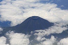
 Aerial view of Mount Pico | |
| Highest point | |
| Elevation | 2,351 m (7,713 ft)[1] |
| Prominence | 2,351 m (7,713 ft)[1] |
| Parent peak | None - HP Pico |
| Listing | Country high point Ultra |
| Coordinates | 38°28′08″N 28°23′56″W / 38.46889°N 28.39889°W[1] |
| Geography | |
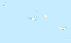
| Location | Pico Island, Azores |
| Parent range | Mid-Atlantic Ridge |
| Geology | |
| Rock age | < 230,000 Years |
| Mountain type | Stratovolcano |
| Last eruption | July to December 1720[2] |
| Climbing | |
| Easiest route | Scramble, Class 2; YDS Grade II |
| Mount Pico Nature Reserve | |
|---|---|
 | |
 | |
| Area | 13.41 km2 (5.18 sq mi)[3] |
| Established | 1972 |
| Visitors | > 20,000 (in 2019)[4] |
| Governing body | ICNF |
Mount Pico (Portuguese: Montanha do Pico) is a currently dormant stratovolcano located on Pico Island, in the mid-Atlantic archipelago of the Azores. It is the highest mountain in Portugal, at 2,351 metres (7,713 ft) above sea level, and is one of the highest Atlantic mountains; it is more than twice the elevation of any other peak in the Azores. It has been a designated nature reserve since 1972.
- ^ a b c Cite error: The named reference
peaklistwas invoked but never defined (see the help page). - ^ "Pico". Global Volcanism Program. Smithsonian Institution. Retrieved 2019-03-20.
- ^ "Montanha Do Pico". dopa-explorer.jrc.ec.europa.eu. Retrieved 14 June 2021.
- ^ "Montanha do Pico em alta nas visitas: horário de apoio às subidas vai ser alargado" (in Portuguese). Público. 22 January 2020. Retrieved 6 July 2021.


