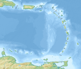
| Mount Scenery | |
|---|---|
 Saba with Mount Scenery's peak in the clouds | |
| Highest point | |
| Elevation | 887 m (2,910 ft) |
| Prominence | 887 m (2,910 ft) |
| Listing | Country high point |
| Coordinates | 17°38′06″N 63°14′21″W / 17.63500°N 63.23917°W |
| Geography | |
| Location | Saba, Caribbean Netherlands |
| Geology | |
| Mountain type | Stratovolcano with lava dome |
| Volcanic arc | Lesser Antilles Volcanic Arc |
| Last eruption | 1640 |
Mount Scenery is a dormant volcano in the Caribbean Netherlands. Its lava dome forms the summit of the Saba island stratovolcano. At an elevation of 887 m (2,910 ft),[1] it is the highest point in both the Kingdom of the Netherlands, and, since the dissolution of the Netherlands Antilles on 10 October 2010, the highest point in the Netherlands proper.
The Saba volcano is potentially dangerous. It is currently classified as "dormant", which means it is an active volcano that is not erupting now, but could erupt in the future.[2] The last eruption was in or around the year 1640[1] which included explosions and pyroclastic flows. The most recent major eruption was at least 5,000 years ago.[3] According to the U.S. Global Volcanism Program, Saba's volcano is the northernmost active volcano in the Caribbean.[1]
On 2 September 2019, Mount Scenery Nature Park was elevated to the status of national park.[4] It has a hiking trail to the summit of the volcano, which is one of Saba's biggest tourist attractions. Along the way up the mountain are the multiple climate zones of Saba, including a cloud forest at the summit.[5][6]
- ^ a b c "Saba". Global Volcanism Program. Smithsonian Institution. Retrieved 30 August 2020.
- ^ "Active, dormant, and extinct: Clarifying confusing classifications | U.S. Geological Survey". www.usgs.gov. Retrieved 2024-02-08.
- ^ "About Saba". Saba Tourism. 2018-06-21. Retrieved 2024-02-07.
- ^ "National park status for Mount Scenery Nature Park - Saba News". www.saba-news.com. Archived from the original on 2019-09-07.
- ^ Cite error: The named reference
:3was invoked but never defined (see the help page). - ^ Cite error: The named reference
:2was invoked but never defined (see the help page).

