| Mount Wilson New South Wales | |||||||||||||||
|---|---|---|---|---|---|---|---|---|---|---|---|---|---|---|---|
 Autumn foliage at Mount Wilson | |||||||||||||||
 | |||||||||||||||
| Coordinates | 33°30′S 150°23′E / 33.500°S 150.383°E | ||||||||||||||
| Population | 81 (2021 census)[1] | ||||||||||||||
| Established | 1880 | ||||||||||||||
| Postcode(s) | 2786 | ||||||||||||||
| Elevation | 1,008 m (3,307 ft) | ||||||||||||||
| Location |
| ||||||||||||||
| LGA(s) | City of Blue Mountains | ||||||||||||||
| State electorate(s) | Blue Mountains | ||||||||||||||
| Federal division(s) | Macquarie | ||||||||||||||
| |||||||||||||||
| Mount Wilson | |
|---|---|
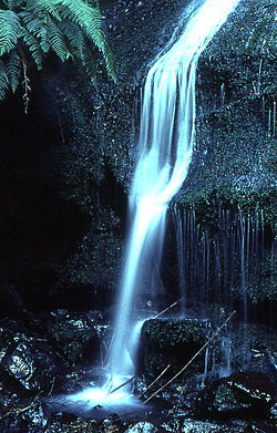
 Tributary to Waterfall Creek, Waterfall Reserve | |
| Highest point | |
| Elevation | 1,008 m (3,307 ft) |
| Parent peak | Bell Range |
| Coordinates | 33°31′S 150°22′E / 33.517°S 150.367°E[2] |
| Geography | |
| Location | Blue Mountains, New South Wales, Australia |
Mount Wilson is a village in the Blue Mountains region of New South Wales, Australia. The village is about 14 kilometres (8.7 mi) east of the township of Bell, and about 100 kilometres (62 mi) west of the Sydney CBD. At the 2021 census, the village of Mount Wilson had a population of 81 people.[1] Mount Wilson is known for its multiple large gardens, walks and access to nature, and popularity as a base for practitioners of canyoning.
- ^ a b Australian Bureau of Statistics (28 June 2022). "Mount Wilson". 2021 Census QuickStats. Retrieved 21 September 2022.
- ^ "Mount Wilson (mountain)". Geographical Names Register (GNR) of NSW. Geographical Names Board of New South Wales. Retrieved 12 May 2015.
