| Mounth | |
|---|---|
| The Mounth, am Monadh | |
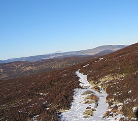
 Typical Mounth scenery | |
| Highest point | |
| Coordinates | 57°02′35″N 2°37′37″W / 57.043°N 2.627°W |
| Naming | |
| English translation | "Mountain" |
| Language of name | Pictish/Common Brittonic[1] |
| Geography | |
The Mounth (/ˈmʌnθ/ MUNTH)[2] is the broad upland in northeast Scotland between the Highland Boundary and the River Dee, at the eastern end of the Grampians.
