Mountrail County | |
|---|---|
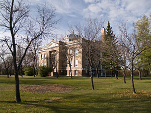
 Mountrail County Courthouse in Stanley | |
 Location within the U.S. state of North Dakota | |
 North Dakota's location within the U.S. | |
| Coordinates: 48°12′N 102°22′W / 48.2°N 102.37°W | |
| Country | |
| State | |
| Founded | January 4, 1873 1892 (eliminated) January 29, 1909 (reestablished) |
| Seat | Stanley |
| Largest city | New Town |
| Area | |
• Total | 1,942 sq mi (5,030 km2) |
| • Land | 1,825 sq mi (4,730 km2) |
| • Water | 116 sq mi (300 km2) 6.0% |
| Population (2020) | |
• Total | 9,809 |
• Estimate (2023) | 9,383 |
| • Density | 5.1/sq mi (2.0/km2) |
| Time zone | UTC−6 (Central) |
| • Summer (DST) | UTC−5 (CDT) |
| Congressional district | At-large |
| Website | www |
Mountrail County is a county in the northwestern part of North Dakota, United States. As of the 2020 census, the population was 9,809.[1] Its county seat is Stanley.[2] The county was originally created in 1873, then removed in 1892, annexed by Ward County. It was re-created and organized in 1909.[3][4] The county is home to the headquarters of the Three Affiliated Tribes of the Mandan, Hidatsa, and Arikara people, and a large part of the county belongs to the tribe's Fort Berthold reservation.[5][6]
- ^ "State & County QuickFacts". United States Census Bureau. Retrieved May 9, 2024.
- ^ "Find a County". National Association of Counties. Retrieved June 7, 2011.
- ^ "County History". North Dakota.gov. The State of North Dakota. Archived from the original on February 2, 2015. Retrieved February 1, 2015.
- ^ Cite error: The named reference
dakotawas invoked but never defined (see the help page). - ^ "Our Tribe". MHA Nation. Retrieved June 28, 2024.
- ^ "Mountrail County ND". www.nd-direct.com. Retrieved June 28, 2024.