Mower County | |
|---|---|
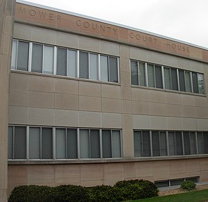
 Mower County Courthouse in Austin | |
 Location within the U.S. state of Minnesota | |
 Minnesota's location within the U.S. | |
| Coordinates: 43°40′N 92°45′W / 43.67°N 92.75°W | |
| Country | |
| State | |
| Founded | February 20, 1855 (created) March 1, 1856 (organized) |
| Named for | John Edward Mower |
| Seat | Austin |
| Largest city | Austin |
| Area | |
• Total | 711.5 sq mi (1,843 km2) |
| • Land | 711.3 sq mi (1,842 km2) |
| • Water | 0.2 sq mi (0.5 km2) 0.03% |
| Population (2020) | |
• Total | 40,029 |
• Estimate (2023) | 40,058 |
| • Density | 56.3/sq mi (21.7/km2) |
| Time zone | UTC−6 (Central) |
| • Summer (DST) | UTC−5 (CDT) |
| Congressional district | 1st |
| Website | www |
Mower County (/ˈmaʊ.ər/)[1] is a county in the U.S. state of Minnesota. As of the 2020 census, the population was 40,029.[2] The county seat is Austin.[3] Mower County comprises the Austin Micropolitan Statistical Area and is included in the Rochester-Austin Combined Statistical Area. Lake Louise State Park is in southeastern Mower County, near Le Roy.
- ^ Upham, Warren (2001). Minnesota Place Names: A Geographical Encyclopedia (3rd ed.). Minnesota Historical Society Press. p. 385. ISBN 0-87351-396-7.
- ^ "State & County QuickFacts". United States Census Bureau. Retrieved April 19, 2023.
- ^ "Find a County". National Association of Counties. Retrieved June 7, 2011.