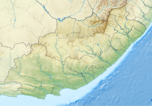
Mthatha Airport Mthatha Lughawe | |||||||||||
|---|---|---|---|---|---|---|---|---|---|---|---|
| Summary | |||||||||||
| Airport type | Public | ||||||||||
| Operator | Provincial Government | ||||||||||
| Serves | Mthatha, King Sabata Dalindyebo Local Municipality, Eastern Cape, South Africa | ||||||||||
| Elevation AMSL | 2,429 ft / 740 m | ||||||||||
| Coordinates | 31°32′47″S 028°40′31″E / 31.54639°S 28.67528°E | ||||||||||
| Map | |||||||||||
 | |||||||||||
| Runways | |||||||||||
| |||||||||||
Mthatha Airport (IATA: UTT, ICAO: FAUT) is an airport serving Mthatha (formerly Umtata), a city in the Eastern Cape province of South Africa. The airport was previously named K. D. Matanzima Airport after Kaiser Matanzima, a president of the former Transkei.[1][2]
- ^ a b "MTHATHA (K. D. MATANZIMA) FAUT Aerodrome Chart" (PDF). South African Civil Aviation Authority. 24 July 2014. Archived from the original (PDF) on 6 October 2014. Retrieved 4 October 2014.
- ^ a b "IATA Airport Code Search (UTT: Umtata / K.D. Matanzima)". International Air Transport Association. Retrieved 17 June 2013.


