Mueang Pan
เมืองปาน | |
|---|---|
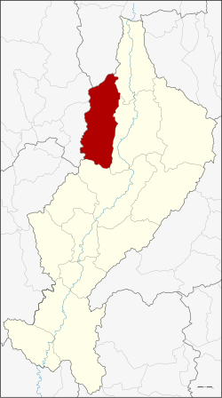
 District location in Lampang province | |
| Coordinates: 18°46′14″N 99°29′54″E / 18.77056°N 99.49833°E | |
| Country | Thailand |
| Province | Lampang |
| Seat | Mueang Pan |
| Area | |
• Total | 865.103 km2 (334.018 sq mi) |
| Population (2005) | |
• Total | 34,494 |
| • Density | 39.9/km2 (103/sq mi) |
| Time zone | UTC+7 (ICT) |
| Postal code | 52240 |
| Geocode | 5213 |
Mueang Pan (Thai: เมืองปาน, pronounced [mɯ̄a̯ŋ pāːn]) is a district (amphoe) in the northern part of Lampang province, northern Thailand.