Mueller | |
|---|---|
Neighborhood | |
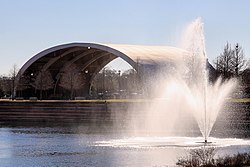
 Lake Park and converted Browning hangar in Mueller Community | |
 Neighborhood Boundaries | |
| Coordinates: 30°17′22″N 97°42′9.49″W / 30.28944°N 97.7026361°W | |
| Country | United States |
| State | Texas |
| City | Austin |
| Area | |
| • Total | 1.11094 sq mi (2.8773 km2) |
| Time zone | UTC-6 (CST) |
| • Summer (DST) | UTC-5 (CDT) |
| ZIP Codes | 78722 - 78723 |
| Area codes | 512, 737 |
| Website | http://www.muelleraustin.com |
Mueller /ˈmɪlər/ is a 711-acre (288 ha) Planned Unit Development (PUD) in the east-central portion of the city of Austin, Texas, United States. The project is in the process of long-term development on the former site of the Robert Mueller Municipal Airport, which was closed in 1999 upon the opening of Austin–Bergstrom International Airport in southeast Austin, itself a civilian adaptation of Bergstrom Air Force Base after its closure in the early 1990s. Mueller is intended to be a pedestrian-oriented, interactive mixed-use community and a model for responsible urban planning and development.