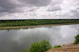
| Mulchatna River | |
|---|---|
 Mulchatna River | |
| Native name | Vałts'atnaq' (Tanaina) |
| Location | |
| Country | United States |
| State | Alaska |
| Census Area | Dillingham |
| Physical characteristics | |
| Source | Turquoise Lake |
| • location | west of the Chigmit Mountains, Lake Clark National Park and Preserve |
| • coordinates | 60°46′56″N 154°00′30″W / 60.78222°N 154.00833°W[1] |
| • elevation | 2,506 ft (764 m)[2] |
| Mouth | Nushagak River |
• location | 65 miles (105 km) northeast of Dillingham |
• coordinates | 59°38′40″N 157°06′55″W / 59.64444°N 157.11528°W[1] |
• elevation | 151 ft (46 m)[1] |
| Length | 160 mi (260 km)[3] |
| Type | Wild |
| Designated | December 2, 1980 |
The Mulchatna River (Dena'ina: Vałts'atnaq') is a 160-mile (260 km) tributary of the Nushagak River in the U.S. state of Alaska.[3] Beginning at Turquoise Lake, it flows generally southwest to meet the larger river 65 miles (105 km) northeast of Dillingham.[1] The Mulchatna's mouth is slightly south (downstream) of the village of Koliganek on the Nushagak, which continues southwest to Nushagak Bay, an arm of Bristol Bay.[4]
The upper 24 miles (39 km) of the river, which flow through Lake Clark National Park and Preserve, became part of the National Wild and Scenic River System in 1980.[5] Aside from scattered cabins, the Mulchatna River is undeveloped. However, there is a proposal to build a large copper/gold mine, the Pebble Mine, in the watershed of one of the Mulchatna tributaries, the Koktuli River.[6]
- ^ a b c d "Mulchatna River". Geographic Names Information System. United States Geological Survey. March 31, 1981. Retrieved November 19, 2013.
- ^ Derived by entering source coordinates in Google Earth.
- ^ a b Orth, Donald J.; United States Geological Survey (1971) [1967]. Dictionary of Alaska Place Names: Geological Survey Professional Paper 567 (PDF). United States Government Printing Office. p. 664. Archived from the original (PDF) on October 17, 2013. Retrieved November 19, 2013.
- ^ Alaska Atlas & Gazetteer (7th ed.). Yarmouth, Maine: DeLorme. 2010. pp. 48–49, 57–58, 66–67, 131. ISBN 978-0-89933-289-5.
- ^ "Mulchatna River, Alaska". National Wild and Scenic Rivers System. Retrieved November 20, 2013.
- ^ Northern Dynasty Mines (2006). "Pebble Project: Application for Groundwater Right" (PDF). Alaska Department of Natural Resources. Retrieved November 20, 2013.
