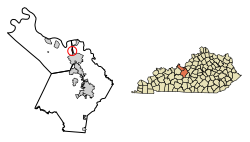
Muldraugh, Kentucky | |
|---|---|
| Nickname: "The Gateway to Gold"[1] | |
 Location in Hardin County, Kentucky | |
| Coordinates: 37°56′13″N 85°59′29″W / 37.93694°N 85.99139°W | |
| Country | United States |
| State | Kentucky |
| Counties | Meade, Hardin |
| Incorporated | 1852[2] |
| Area | |
• Total | 0.52 sq mi (1.36 km2) |
| • Land | 0.52 sq mi (1.35 km2) |
| • Water | 0.00 sq mi (0.00 km2) |
| Elevation | 738 ft (225 m) |
| Population | |
• Total | 1,040 |
| • Density | 1,988.53/sq mi (768.25/km2) |
| Time zone | UTC-5 (Eastern (EST)) |
| • Summer (DST) | UTC-4 (EDT) |
| ZIP code | 40155 |
| Area code | 502 |
| FIPS code | 21-54480 |
| GNIS feature ID | 0499075 |
| Website | muldraugh |
Muldraugh is a home rule-class city in Meade and Hardin counties in the U.S. state of Kentucky. It lies on U.S. Route 31W north of Elizabethtown. The city limits are completely encompassed by the Fort Knox army base. The population was 1,040 as of the 2020 census.[4] The city is part of the Elizabethtown–Fort Knox Metropolitan Area.
- ^ "Welcome to the City of Muldraugh, the gateway to gold!". City of Muldraugh, KY. Retrieved May 17, 2023.
- ^ Commonwealth of Kentucky. Office of the Secretary of State. Land Office. "Muldraugh, Kentucky". Accessed 26 August 2013.
- ^ "2022 U.S. Gazetteer Files: Kentucky". United States Census Bureau. Retrieved May 17, 2023.
- ^ a b "P1. Race – Muldraugh city, Kentucky: 2020 DEC Redistricting Data (PL 94-171)". U.S. Census Bureau. Retrieved May 17, 2023.