| Multnomah Channel | |
|---|---|
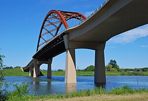
 Passing under the Wapato Bridge | |
| Location | |
| Country | United States |
| State | Oregon |
| County | Multnomah and Columbia |
| Physical characteristics | |
| Source | Willamette River |
| • location | Portland, Multnomah County |
| • coordinates | 45°37′08″N 122°47′47″W / 45.61889°N 122.79639°W[1] |
| • elevation | 19 ft (5.8 m)[1] |
| Mouth | Columbia River |
• location | St. Helens, Columbia County |
• coordinates | 45°51′30″N 122°47′36″W / 45.85833°N 122.79333°W[1] |
• elevation | 8 ft (2.4 m)[1] |
| Length | 21.5 mi (34.6 km)[2] |
The Multnomah Channel is a 21.5-mile (34.6 km) distributary of the Willamette River. It diverges from the main stem a few miles upstream of the main stem's confluence with the Columbia River in Multnomah County in the U.S. state of Oregon. The channel flows northwest then north around Sauvie Island to meet the Columbia River near the city of St. Helens, in Columbia County.
Chinook people, the Multnomahs, lived in villages along the channel at the time of European exploration of the Columbia River in the late 18th and early 19th centuries. Flanked in the 21st century by moorages, marinas, and parks, and populated by a wide variety of fish, the channel offers many opportunities for recreation.
