Munger | |
|---|---|
City | |
 | |
| Nickname: Yoga Nagri[1] | |
| Coordinates: 25°22′52″N 86°27′54″E / 25.381°N 86.465°E | |
| Country | |
| State | Bihar |
| District | Munger |
| Established | 1834 |
| Founded by | Chandragupta Maurya |
| Government | |
| • Type | Municipal Corporation |
| • Body | Munger Municipal Corporation |
| • Mayor | Kumkum Devi |
| • Municipal Commissioner | Kumar Abhishek |
| • MLA,Munger | Pranav Kumar (BJP) |
| Area | |
• Total | 89 km2 (34 sq mi) |
| Elevation | 43 m (141 ft) |
| Population (2011)[3] | |
• Total | 213,101 |
| • Rank | 11th in Bihar |
| • Density | 2,400/km2 (6,200/sq mi) |
| Demonym | Mungeri |
| Language | |
| • Official | Hindi[4] |
| • Additional official | Urdu[4] |
| • Regional | Hindi, English, Angika, Maithili[5] |
| Time zone | UTC+5:30 (IST) |
| PIN | 811201 to 811214 , 813201[6] |
| Telephone code | +91-6344 |
| Vehicle registration | BR-08 |
| Website | munger |
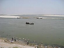
Munger, formerly spelt as Monghyr,[7] is a twin city and a Municipal Corporation situated in the Indian state of Bihar.[8] It is the administrative headquarters of Munger district and Munger Division. Munger was one of the major cities in Eastern India and undivided Bengal during Mughal period and British Raj. It is one of the major political, cultural, educational and commercial center of Bihar and Eastern India. Munger is situated about 180km from east of capital city Patna, about 480km west of Eastern India's largest city Kolkata and 1200km from country's capital New Delhi.
Historically, Munger is known for being an ancient seat of rule. The twin city comprises Munger and Jamalpur situated on the southern bank of the river Ganges.[9] It is situated 08 km from Jamalpur Junction, 180 km east of capital city Patna and 430 Km from Kolkata the capital of West Bengal.

Munger is said to have been founded by the Guptas (4th century CE) and contains a fort that houses the tomb of the Muslim saint Shah Mushk Nafā (died 1497). In 1763, the Nawab of Bengal Mir Qasim made Munger his capital and built an arsenal and several palaces. It was constituted a municipality in 1864.
- ^ "Economy | Munger District, Government of Bihar | India". munger.nic.in. Retrieved 17 March 2021.
- ^ "Munger City" (PDF). nagarseva.bihar.gov.in. Retrieved 22 November 2020.[permanent dead link]
- ^ "Census of India Search details". censusindia.gov.in. Archived from the original on 18 May 2015. Retrieved 10 May 2015.
- ^ a b "52nd Report of the Commissioner for Linguistic Minorities in India" (PDF). nclm.nic.in. Ministry of Minority Affairs. Archived from the original (PDF) on 25 May 2017. Retrieved 3 January 2019.
- ^ "language | Munger District, Government of Bihar | India". munger.nic.in. Retrieved 12 March 2022.
- ^ "MUNGER Pin Code - 811201, Munger All Post Office Areas PIN Codes, Search MUNGER Post Office Address". ABP Live. Retrieved 27 July 2022.
- ^ Kerkhoff, Kathinka Sinha (2014). Colonising Plants in Bihar (1760-1950). PartridgeIndia. p. 229. ISBN 978-1-4828-3911-1.
- ^ "CDP Munger" (PDF). Urban department, Government of Bihar. Archived (PDF) from the original on 3 March 2016. Retrieved 31 December 2017.
- ^ "CDP Jamalpur" (PDF). Urban Department, Government of Bihar. Archived (PDF) from the original on 9 May 2016. Retrieved 31 December 2017.

