| Romford | |
|---|---|
 Romford Town Hall | |
 Romford within Essex in 1961 | |
| Area | |
| • 1911 | 5,630 acres (22.8 km2)[1] |
| • 1931 | 5,627 acres (22.8 km2)[1] |
| • 1961 | 9,342 acres (37.8 km2)[1] |
| Population | |
| • 1911 | 16,970[1] |
| • 1931 | 35,918[1] |
| • 1961 | 114,584[1] |
| Density | |
| • 1911 | 3/acre |
| • 1931 | 6/acre |
| • 1961 | 12/acre |
| History | |
| • Created | 1894 |
| • Abolished | 1965 |
| • Succeeded by | London Borough of Havering |
| Status | Local board district (1851–1894) Urban district (1894–1937) Municipal borough (1937–1965) |
| Government | Romford Board of Health (1851–1894) Romford Urban District Council (1894–1937) Romford Borough Council (1937–1965) |
| • HQ | Romford |
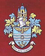
| • Motto | Serve with gladness |
 Coat of arms of the borough council | |
| Subdivisions | |
| • Type | Civil parishes |
| • Units | Romford (1851–1894)[note a] Romford Urban (1894–1900) Romford (1900–1965) Noak Hill (1934–1965) Havering-atte-Bower (1934–1965) |
Romford was a local government district in southwest Essex from 1851 to 1965 around the town of Romford.[2] It was significantly expanded in 1934 and gained the status of municipal borough in 1937. The population density of the district consistently increased during its existence[1] and its former area now corresponds to the northern part of the London Borough of Havering in Greater London.
- ^ a b c d e f g Vision of Britain - Romford population (area and density)
- ^ Vision of Britain - Romford UD/MB (historic map[permanent dead link])