| Murray Darling Depression Murray-Darling woodlands and mallee | |
|---|---|
 | |
 The IBRA regions, with Murray Darling Depression in red | |
| Ecology | |
| Realm | Australasian |
| Biome | Mediterranean forests, woodlands, and scrub |
| Borders | |
| Geography | |
| Area | 197,900 km2 (76,400 sq mi) |
| Country | Australia |
| States | |
| Coordinates | 35°12′S 141°36′E / 35.2°S 141.6°E |
| Conservation | |
| Conservation status | Critical/endangered |
| Protected | 31,000 km² (15%)[1] |
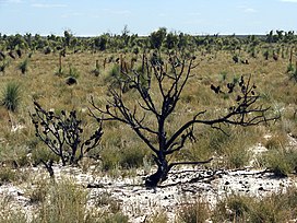
The Murray Darling Depression , also known as the Murray-Darling woodlands and mallee, is a 19,717,651 HA biogeographic region and an ecoregion in southeastern Australia consisting of a wooded plain through which flow two of Australia's biggest rivers, the Murray and the Darling. There are several modern human settlements in the bioregion including Ivanhoe and Manilla, but the region also contains some of the oldest known human occupation sites in Australia. [2] [3] [4]
- ^ Dinerstein, Eric; Olson, David; et al. (June 2017). "An Ecoregion-Based Approach to Protecting Half the Terrestrial Realm". BioScience. 67 (6): 534–545. doi:10.1093/biosci/bix014. PMC 5451287. PMID 28608869.
{{cite journal}}: CS1 maint: date and year (link) Supplemental material 2 table S1b. - ^ "Map of Ecoregions 2017". Resolve. Retrieved August 20, 2021.
- ^ "Murray-Darling woodlands and mallee". Digital Observatory for Protected Areas. Retrieved August 20, 2021.
- ^ "Murray-Darling woodlands and mallee". The Encyclopedia of Earth. Retrieved August 20, 2021.