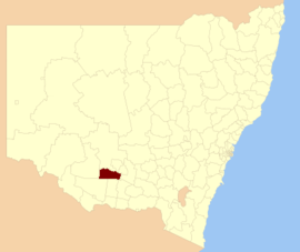
| Murrumbidgee Shire New South Wales | |||||||||||||||
|---|---|---|---|---|---|---|---|---|---|---|---|---|---|---|---|
 Shire office and chambers, in Darlington Point. | |||||||||||||||
 Location within New South Wales | |||||||||||||||
| Coordinates | 34°48′S 145°53′E / 34.800°S 145.883°E | ||||||||||||||
| Population | 2,415 (2012)[1] | ||||||||||||||
| • Density | 0.68843/km2 (1.7830/sq mi) | ||||||||||||||
| Abolished | 2016 | ||||||||||||||
| Area | 3,508 km2 (1,354.4 sq mi) | ||||||||||||||
| Council seat | Darlington Point[2] | ||||||||||||||
| Region | Riverina | ||||||||||||||
| State electorate(s) | Murray | ||||||||||||||
| Federal division(s) | Riverina | ||||||||||||||
| |||||||||||||||
Murrumbidgee Shire was a local government area in the Riverina region of south western New South Wales, Australia. The Shire was located adjacent to the Murrumbidgee River and the Newell Highway.
The two main administrative centres for the Murrumbidgee Shire were Coleambally and Darlington Point. It also contained the small town of Waddi.
- ^ "3218.0 – Regional Population Growth, Australia, 2012". Australian Bureau of Statistics. 30 August 2013. Retrieved 27 March 2014. Estimated resident population (ERP) at 30 June 2012.
- ^ "Murrumbidgee Shire Council". Department of Local Government. Retrieved 9 November 2006.