This article needs additional citations for verification. (May 2017) |
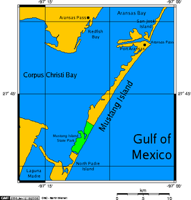
 Map showing Mustang Island, in a long chain of barrier islands (see: Padre Island, to the south). | |
 | |
| Geography | |
|---|---|
| Location | Gulf of Mexico |
| Length | 18 mi (29 km) |
| Highest elevation | 3 ft (0.9 m) |
| Administration | |
United States | |
| State | Texas |
| County | Nueces |
| Additional information | |
| Official website | tpwd |

Mustang Island is a barrier island on the Gulf Coast of Texas in the United States. The island is 18 miles (29 km) long, stretching from Corpus Christi to Port Aransas. The island is oriented generally northeast–southwest, with the Gulf of Mexico on the east and south, and Corpus Christi Bay on the north and west. The island's southern end connects by roadway to Padre Island. At the northern end of the island is Port Aransas, beyond which is San José Island. The Aransas Channel, also known as the "Aransas Pass," which separates Mustang Island from San José Island, is protected by jetties extending into the Gulf from each island.
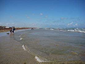
The town of Port Aransas is located at the northern end of the island. Mustang Island State Park encompasses the entire southern third of the island, including 3,955 acres (1,600 ha) and 5 miles (8 km) of beach. The city of Corpus Christi includes the northernmost portion of Padre Island and part of Mustang Island between Port Aransas and the state park.
The island is a popular Spring Break destination for its beaches and is also popular with snowbirds, Northerners and Canadians who spend their winters in warm climates.