| Muzart Pass | |
|---|---|
 Xiata Valley looking south, Muzart Pass turns right before the snow-capped mountains | |
| Elevation | 3,582 m (11,752 ft)[1] |
| Traversed by | Xiata Trail (夏塔古道) or Xiate Trail (夏特古道) |
| Location | between Ili Prefecture and Aksu Prefecture in Xinjiang, China |
| Range | Tian Shan |
| Coordinates | 42°21′32″N 80°47′53″E / 42.359°N 80.798°E |
 | |
| Muzart Pass | |||
|---|---|---|---|
| Traditional Chinese | 木扎爾特達坂 | ||
| Simplified Chinese | 木扎尔特达坂 | ||
| |||
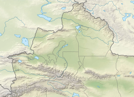
The Muzart Pass, Muz-art Pass, or Muzat Pass[2] (Chinese: 木扎尔特达坂) is a high mountain pass[3] that crosses the Tian Shan mountains in Xinjiang, China. It connects the city of Aksu in Tarim Basin with the city of Yining (Kulja) in the upper Ili River valley.[1] It is located on the county boundary between Zhaosu County in Ili Prefecture and Baicheng County in Aksu Prefecture. The route over Muzart Pass is more commonly referred to as Xiata Trail (Chinese: 夏塔古道) or Xiate Trail (Chinese: 夏特古道) by the Chinese,[1] Xiata being the name of the village in Tekes River valley at the base on the northern side of the route.
China National Highway 219 is in the process of being extended to cross Tian Shan connecting Zhaosu County with Wensu County in Tarim Basin. There are two routes under investigation -- the western and shorter route will traverse Muzart Pass.[4]
- ^ a b c Paul Knott; Bruce Normand (2009). "Untapped Potential, Exploring the Chinese Central Tien Shan". American Alpine Journal. Retrieved 4 February 2020.
The historic Xiate Trail traverses the range from north to south. This was an important trade route from Ili over to the Muzart Gorge, and hence to the Aksu region and southern Xinjiang. The trail is notable for crossing glacial terrain and a high pass at 3,582 meters. ... A short drive from Zhaosu took us to the roadhead at Xiata Hot Springs (2,380m). ... the authorities are developing the Xiata Valley as a tourist center. A new concrete bridge and hotel are under construction at the hot springs and an upgrade of the access road is mostly complete. ... Above the pastures we followed a good trail over the Muzart Pass (3,582m) to a base camp at Hadamuzi (3,525m), a beautiful meadow overlooking the Muzart (Benzhaerte) Glacier directly opposite Baiyu Feng.
- ^ Cite error: The named reference
society_of_artswas invoked but never defined (see the help page). - ^ Demetrius Charles Boulger, A Life of Yakub Beg, 1878, pages 7,12,61.
- ^ 李剑 (2021-10-18). "从北疆到南疆 219国道 如何穿越南天山?". Chinese National Geography. Retrieved 23 February 2022.
经过勘察这条线路有两个方案:西线走廊,昭苏县至温宿县,部分路线与夏特古道重合,里程445公里;东线走廊,特克斯县至拜城县,部分线路与乌孙古道重合,里程580公里。两条线路都需要打隧道才能通过达坂,昭苏至温宿线需要长度16公里的隧道;特克斯至拜城线需要长度40—80公里的隧道,工程难度更大。

