| Mwenezi River Nuanetsi River | |
|---|---|
 Mwenezi River in Zimbabwe lowveld | |
| Location | |
| Country | Zimbabwe, Mozambique |
| Physical characteristics | |
| Source | |
| • location | Insiza District, South Central Zimbabwe |
| • elevation | 1,195 m (3,921 ft)[1] |
| Mouth | |
• location | Limpopo River |
• elevation | 149 m (489 ft) |
| Basin size | 14,759 km2 (5,698 sq mi) |
| Discharge | |
| • average | 14.34 mm/a (0.565 in/year) (unit flow)[2] |
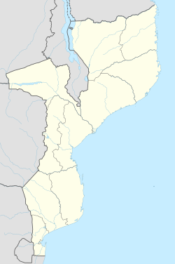
The Mwenezi River, originally known as the Nuanetsi River, is a major tributary of the Limpopo River. The Mwenezi River starts up in south central Zimbabwe and flows south-east along what is known as the Mwenezi River Valley that bisects the district into two sectors.[3][4] The river is found in both Zimbabwe and Mozambique. In Zimbabwe it has been known as the Nuanetsi or Nuanetzi River in the past, a name it retains in Mozambique.[5]
The river flows through Gonarezhou National Park on its way to joining the mighty Limpopo River. The Mwenezi river is a major tributary and flows north–south. They do not meet in Zimbabwe, but converge to a distance of 20 kilometres (12 mi) downstream into Chicualacuala District, Mozambique. In between is the Sengwe Communal Land in Chiredzi District of Masvingo Province, mostly a flat and undulating area around 300 metres (980 ft) in elevation.
- ^ Height of river in Insiza District, quoted as per Cebuano wiki-article
- ^ Görgens, A.H.M. and Boroto, R.A. 1997. Limpopo River: flow balance anomalies, surprises and implications for integrated water resources management. In: Proceedings of the 8th South African National Hydrology Symposium, Pretoria, South Africa.
- ^ Mwenezi River & tributaries in Mwenezi (District) Archived 18 March 2007 at the Wayback Machine
- ^ Flora of Zimbabwe [1](accessed 20 February 2008)
- ^ Ministério da Administração Estatal 2005. Perfil do Distrito de Chicualacuala, Província de Gaza, page 2 "Archived copy" (PDF). Archived from the original (PDF) on 20 November 2008. Retrieved 8 August 2008.
{{cite web}}: CS1 maint: archived copy as title (link)
