| Mount Mycale | |
|---|---|
| Μυκάλη Samsun Dağı | |
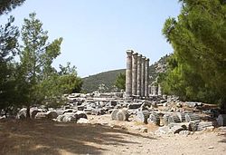
 The flanks of Mycale behind Priene | |
| Highest point | |
| Elevation | 1,237 m (4,058 ft) at Dilek Tepesi, the high point; 600 m (1,969 ft) average |
| Coordinates | 37°39′40″N 27°09′02″E / 37.66111°N 27.15056°E |
| Naming | |
| English translation | Samson's Mountain |
| Language of name | Turkish language |
| Geography | |
Aydin Province, Republic of Turkey | |
| Parent range | Aydin Mountain Range in the Menderes Massif |
| Geology | |
| Mountain type(s) | Ridge, 20 km (12 mi) long |
| Climbing | |
| Easiest route | Hike |
Mycale (/ˈmɪkəli/) also Mykale and Mykali (Ancient Greek: Μυκάλη, Mykálē), called Samsun Dağı and Dilek Dağı (Dilek Peninsula) in modern Turkey, is a mountain on the west coast of central Anatolia in Turkey, north of the mouth of the Maeander and divided from the Greek island of Samos by the 1.6 km wide Mycale Strait. The mountain forms a ridge, terminating in what was known anciently as the Trogilium promontory (Ancient Greek Τρωγίλιον or Τρωγύλιον).[1] There are several beaches on the north shore ranging from sand to pebbles. The south flank is mainly escarpment.
In the Late Bronze Age, it may have been known under the Hittite name Arrinnanda.
In classical Greece nearly the entire ridge was a promontory enclosed by the Aegean Sea. Geopolitically it was part of Ionia with Priene placed on the coast on the south flank of the mountain and Miletus on the coast opposite to the south across the deep embayment into which the Maeander River drained. Somewhat further north was Ephesus.
The ruins of the first two Ionian cities mentioned with their harbor facilities remain but today are several miles inland overlooking instead a rich agricultural plain and delta parkland created by deposition of sediments from the river, which continues to form the geological feature named after it, maeanders. The end of the former bay remains as a lake, Çamiçi Gölü (Lake Bafa). Samsun Daği, or Mycale, still has a promontory.
The entire ridge was designated as a national park in 1966; Dilek Yarimadisi Milli Parki ("Dilek Peninsula National Park") has 109.85 km2 (27,145 acres), which is partly accessible to the public. The remainder is a military reservation. The park's isolation has encouraged the return of the native ecology, which is 60% maquis shrubland. It is a refuge for species that used to be more abundant in the region.
- ^ Smith, William (1850). "Mycale". New Classical Dictionary of Biography, Mythology and Geography. London: John Murray.. Downloadable Google Books.
