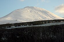
| Mynydd Troed | |
|---|---|
 | |
| Highest point | |
| Elevation | 609 m (1,998 ft) |
| Prominence | 286 m (938 ft) |
| Listing | Marilyn |
| Geography | |
| Location | Brecon Beacons |
| OS grid | SO165292 |

Mynydd Troed is a hill in the Black Mountains of the Brecon Beacons National Park in Powys, south Wales. Its name literally translates to "Foot Mountain," based how it appears when viewed from the Allt Mawr ridge.
It lies 3 miles (4.8 km) south of Talgarth and 2 miles (3.2 km) northeast of the village of Llangors on the western side of the range. Its summit at the northern end of a northwest to southeast aligned ridge reaches 609 metres (1,998 ft) above sea level and is crowned by a trig point.[1]
- ^ Ordnance Survey Explorer map OL13 'Brecon Beacons National Park: eastern area'