| Mzingwane River | |
|---|---|
 | |
 | |
| Location | |
| Country | Zimbabwe |
| Physical characteristics | |
| Source | |
| • location | South of Bulawayo, Zimbabwe |
| Mouth | |
• location | Limpopo River, South Africa–Zimbabwe border |
• coordinates | 22°11′13″S 29°55′32″E / 22.18694°S 29.92556°E |
• elevation | 452 m (1,483 ft) |
| Basin size | 15,695 km2 (6,060 sq mi) |
| Discharge | |
| • average | 22.30 m3/s (788 cu ft/s) |
| [1] | |
Location of the Mzingwane River's mouth
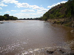
The Mzingwane River, formerly known as Umzingwane River or Umzingwani River, is a major left-bank tributary of the Limpopo River in Zimbabwe. It rises near Fort Usher, Matobo District, south of Bulawayo and flows into the Limpopo River near Beitbridge, downstream of the mouth of the Shashe River and upstream of the mouth of the Bubye River.
- ^ Görgens, A.H.M.; Boroto, R.A. (1997). Limpopo River: flow balance anomalies, surprises and implications for integrated water resources management. Proceedings of the 8th South African National Hydrology Symposium. Pretoria.
