| Nadym | |
|---|---|
 | |
| Location | |
| Country | Russia |
| Physical characteristics | |
| Source | Numto |
| Mouth | Gulf of Ob |
• coordinates | 66°11′00″N 72°01′00″E / 66.1833°N 72.0167°E |
| Length | 545 km (339 mi) |
| Basin size | 64,000 km2 (25,000 sq mi) |
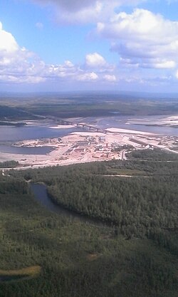
The Nadym (Russian: Нады́м) is a river in Yamalo-Nenets Autonomous Okrug, Russia. The length of the Nadym is 545 kilometers (339 mi). The area of its basin is 64,000 square kilometers (25,000 sq mi).[1]
It is known for having a very rickety pontoon bridge[2] for summer use while winter roads go over the ice. A new fixed bridge for combined road and rail use[3] is to be finished by the end of 2015.[4]
This article needs to be updated. (June 2020) |
- ^ "Река НАДЫМ in the State Water Register of Russia". textual.ru (in Russian).
- ^ "Driver's terrifying crossing of floating bridge in Russia goes viral". The Telegraph. 1 October 2013. Archived from the original on 26 October 2013.
- ^ Сombination bridge over nadym river on 991 km highway Surgut-Salekhard near Nadym, Russia, Institute Giprostroymost, retrieved 5 March 2015
- ^ ГТРК "Ямал" (16 Feb 2015), Мост через реку Надым свяжет северян с континентом [Bridge over the River Nadym Connects Northerners with the Continent] (in Russian), Вести.Ru, retrieved 5 Mar 2015