This article may require cleanup to meet Wikipedia's quality standards. The specific problem is: Check Special:WhatLinksHere for biographies that link here and are from here, and add to notable people list list. (February 2023) |
Nahant, Massachusetts | |
|---|---|
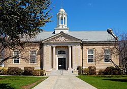
 Town Hall of Nahant | |
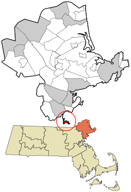
 Location in Essex County and the state of Massachusetts. | |
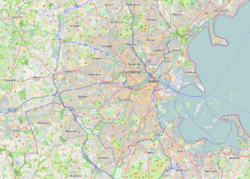
| Coordinates: 42°25′35″N 70°55′10″W / 42.42639°N 70.91944°W | |
| Country | United States |
| State | Massachusetts |
| County | Essex |
| Settled | 1630 |
| Incorporated | March 29, 1853 |
| Government | |
| • Type | Open town meeting |
| • Town Administrator | Antonio Barletta |
| Area | |
• Total | 15.5 sq mi (40.1 km2) |
| • Land | 1.0 sq mi (2.7 km2) |
| • Water | 14.4 sq mi (37.4 km2) |
| Elevation | 50 ft (15 m) |
| Population (2020) | |
• Total | 3,334 |
| • Density | 3,198.2/sq mi (1,234.8/km2) |
| Time zone | UTC-5 (Eastern) |
| • Summer (DST) | UTC-4 (Eastern) |
| ZIP code | 01908 |
| Area code | 339 / 781 |
| FIPS code | 25-43580 |
| GNIS feature ID | 0618304 |
| Website | www |
Nahant (/nəˈhɑːnt/) is a town in Essex County, Massachusetts, United States. The population was 3,334 at the 2020 census, which makes it the smallest municipality by population in Essex County.[1] With just 1.0 square mile (2.7 km2) of land area, it is also the smallest municipality by area in the state and is primarily a residential community. The town is situated on a peninsula consisting of two near-islands (known as "Little Nahant" and "Big Nahant" respectively) connected to the mainland by a narrow sandy isthmus traversed by a single causeway known as "Nahant Road". Numerous tourist beaches line the shores, with the most popular being the so-called "Long Beach" and "Short Beach" along the eastern side of the causeway.
- ^ "Census - Geography Profile: Nahant town, Essex County, Massachusetts". United States Census Bureau. Retrieved September 29, 2021.


