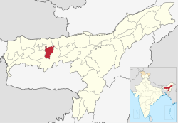
Nalbari district | |
|---|---|
 Daul Mandir | |
 Location in Assam | |
| Country | |
| State | Assam |
| Division | Lower Assam |
| Headquarters | Nalbari |
| Government | |
| • Lok Sabha constituencies | Mangaldoi, Gauhati, Barpeta |
| • Vidhan Sabha constituencies | Nalbari, Barkhetry, Dharmapur |
| Area | |
| • Total | 2,257 km2 (871 sq mi) |
| Population (2011) | |
| • Total | 771,639 |
| • Density | 340/km2 (890/sq mi) |
| Demographics | |
| • Literacy | 79.89% |
| • Sex ratio | 945 |
| Time zone | UTC+05:30 (IST) |
| ISO 3166 code | IN-AS |
| Website | http://nalbari.nic.in/ |
Nalbari (Pron: nɔ:lˈbɑ:ri) is an administrative district in the state of Assam in India. The district headquarters is located at Nalbari. The district derives its name from the combination of two words, "Nal" and "Bar."
It is situated in the lower region of the Brahmaputra Valley and shares its borders with Baksa, Kamrup, and Barpeta districts.
