Nanguan
南关区 | |||||||||||||||||||||||||||||||||
|---|---|---|---|---|---|---|---|---|---|---|---|---|---|---|---|---|---|---|---|---|---|---|---|---|---|---|---|---|---|---|---|---|---|
 | |||||||||||||||||||||||||||||||||
| Coordinates: 43°51′26″N 125°20′12″E / 43.8573°N 125.3366°E[1] | |||||||||||||||||||||||||||||||||
| Country | People's Republic of China | ||||||||||||||||||||||||||||||||
| Province | Jilin | ||||||||||||||||||||||||||||||||
| Sub-provincial city | Changchun | ||||||||||||||||||||||||||||||||
| Area | |||||||||||||||||||||||||||||||||
• Total | 535 km2 (207 sq mi) | ||||||||||||||||||||||||||||||||
| Population (2010)[3] | |||||||||||||||||||||||||||||||||
• Total | 876,959 | ||||||||||||||||||||||||||||||||
| • Density | 1,600/km2 (4,200/sq mi) | ||||||||||||||||||||||||||||||||
| Time zone | UTC+8 (China Standard) | ||||||||||||||||||||||||||||||||
| Changchun district map |
| ||||||||||||||||||||||||||||||||
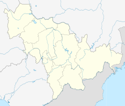
Nanguan District (Chinese: 南关区; pinyin: Nánguān Qū) is one of seven districts of the prefecture-level city of Changchun, the capital of Jilin Province, Northeast China, and forms part of the urban core. It borders the districts of Kuancheng to the north, Erdao to the northeast, Shuangyang to the southeast, Chaoyang to the west, and the prefecture-level city of Siping to the south.
- ^ "Nanguan" (Map). Google Maps. Retrieved 2014-07-02.
- ^ Changchun Statistical Yearbook 2011 (《长春统计年鉴2011》). Accessed 8 July 2014.
- ^ 2010 Census county-by-county statistics (《中国2010年人口普查分县资料》). Accessed 8 July 2014.

