Nannestad Municipality
Nannestad kommune | |
|---|---|
 The characteristic landscape of Nannestad | |
|
| |
 Akershus within Norway | |
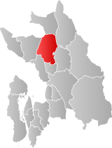
 Nannestad within Akershus | |
| Coordinates: 60°14′44″N 10°57′10″E / 60.24556°N 10.95278°E | |
| Country | Norway |
| County | Akershus |
| District | Romerike |
| Administrative centre | Teigebyen |
| Government | |
| • Mayor (2007-) | Anne-Ragni K. Amundsen (Ap) |
| Area | |
| • Total | 341 km2 (132 sq mi) |
| • Land | 324 km2 (125 sq mi) |
| • Rank | #259 in Norway |
| Population (2012) | |
| • Total | 11,362 |
| • Rank | #102 in Norway |
| • Density | 31/km2 (80/sq mi) |
| • Change (10 years) | |
| Demonym | Nannestadsokning[1] |
| Official language | |
| • Norwegian form | Bokmål |
| Time zone | UTC+01:00 (CET) |
| • Summer (DST) | UTC+02:00 (CEST) |
| ISO 3166 code | NO-3238[3] |
| Website | Official website |
Nannestad is a municipality in Akershus county, Norway. It is part of the traditional region of Romerike. The administrative centre of the municipality is the village of Teigebyen.
- ^ "Navn på steder og personer: Innbyggjarnamn" (in Norwegian). Språkrådet.
- ^ "Forskrift om målvedtak i kommunar og fylkeskommunar" (in Norwegian). Lovdata.no.
- ^ Bolstad, Erik; Thorsnæs, Geir, eds. (2023-01-26). "Kommunenummer". Store norske leksikon (in Norwegian). Kunnskapsforlaget.

