| Narsinghpur State | |||||||
|---|---|---|---|---|---|---|---|
| Princely State of British India | |||||||
| 17th cen–1948 | |||||||
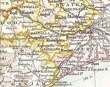
 Narsinghpur State in the Imperial Gazetteer of India | |||||||
| Area | |||||||
• 1901 | 515 km2 (199 sq mi) | ||||||
| Population | |||||||
• 1901 | 39,613 | ||||||
| History | |||||||
• Established | 17th cen | ||||||
| 1948 | |||||||
| |||||||
Narsinghpur State (Odia: ନରସିଂହପୁର) was one of the princely states of India during the British Raj. The state was founded in the 17th century and had its capital in Narasinghpur town. The last ruler of Narsinghpur joined the state to the Indian Union in 1948 and Narsinghpur state was made part of the Cuttack district of Odisha.[1]
The state was bound in the north by a forested mountain range which marked the border with Hindol State and Angul District; in the east it was bound by Baramba State and in the south and southwest by the Mahanadi River.[2]
- ^ Narsinghpur Princely State
- ^ Imperial Gazetteer of India. Vol. 18. 1908. p. 385.