Narva (Нарва) | |
|---|---|
City | |
 Narva's medieval Hermann Castle by the Narva river | |
| Coordinates: 59°22′33″N 28°11′46″E / 59.37583°N 28.19611°E | |
| Country | |
| County | |
| First mentioned | 1172 |
| City rights | 1345 |
| Government | |
| • Mayor | Jaan Toots |
| Area | |
• Total | 84.54 km2 (32.63 sq mi) |
| Elevation | 25 m (82 ft) |
| Population (2023)[1] | |
• Total | 53,626 |
| • Rank | 3rd |
| • Density | 630/km2 (1,600/sq mi) |
| Demonym(s) | Narvitian (English) narvalane (Estonian) |
| Ethnicity (2011)[2] | |
| • Russians | 87.7% |
| • Estonians | 5.2% |
| • other | 7.1% |
| Time zone | UTC+2 (EET) |
| • Summer (DST) | UTC+3 (EEST) |
| Postal code | 20001 to 21020 |
| Area code | (+372) 035 |
| ISO 3166 code | EE-511 |
| Website | www |
 | |
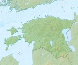
Narva[a] is a municipality and city in Estonia. It is located in the Ida-Viru County, at the eastern extreme point of Estonia, on the west bank of the Narva river which forms the Estonia–Russia international border. With 53,626 inhabitants (as of 2023) Narva is Estonia's third largest city after capital Tallinn and Tartu.
Narva was nearly completely destroyed in 1944 during World War II.[3] During the Soviet era of Estonia in 1944–1991, the city's original inhabitants were not permitted to return, and immigrant workers from Soviet Russia and other parts of the former Soviet Union (USSR) were introduced.[4][3] Narva’s population, 65% ethnic Estonian as of the 1934 census, became overwhelmingly non-Estonian in the second half of the 20th century.[4] According to more recent data, 46.7% of the city's inhabitants are citizens of Estonia, 36.3% are citizens of the Russian Federation, while 15.3% have undefined citizenship.[5]
- ^ Population by sex, age and place of residence after the 2017 administrative reform, 1 January. Statistics Estonia.
- ^ Census 2011: population by ethnic nationality, sex, age group and place of residence. Statistics Estonia.
- ^ a b Cite error: The named reference
kattagowas invoked but never defined (see the help page). - ^ a b Duncan, W. Raymond (2019). Ethnic Nationalism And Regional Conflict: The Former Soviet Union And Yugoslavia. Routledge. ISBN 9780429715938.
- ^ "Üldinfo - Narva Linnavalitsus" [Narva in figures] (PDF). www.narva.ee. 2013.
Cite error: There are <ref group=lower-alpha> tags or {{efn}} templates on this page, but the references will not show without a {{reflist|group=lower-alpha}} template or {{notelist}} template (see the help page).


