| Nathalia Victoria | |||||||||||||||
|---|---|---|---|---|---|---|---|---|---|---|---|---|---|---|---|
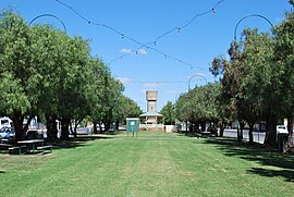
 Park in the centre of Blake St, the main street of town | |||||||||||||||
| Coordinates | 36°03′30″S 145°12′13″E / 36.05833°S 145.20361°E | ||||||||||||||
| Population | 1,982 (2021 census)[1] | ||||||||||||||
| Established | 1875 | ||||||||||||||
| Postcode(s) | 3638 | ||||||||||||||
| Location |
| ||||||||||||||
| LGA(s) | Shire of Moira | ||||||||||||||
| State electorate(s) | Shepparton | ||||||||||||||
| Federal division(s) | Nicholls | ||||||||||||||
| |||||||||||||||
Nathalia (/nəˈθeɪliə/ nə-THAY-li-ə)[2] is a town in northern Victoria, Australia. The town is located within the Shire of Moira local government area on the banks of Broken Creek and on the Murray Valley Highway. At the 2021 census, Nathalia had a population of 1,982.[1]
- ^ a b Australian Bureau of Statistics (28 June 2022). "Nathalia (State Suburb)". 2021 Census QuickStats. Retrieved 20 August 2012.
- ^ Macquarie Dictionary, Fourth Edition (2005). Melbourne, The Macquarie Library Pty Ltd. ISBN 1-876429-14-3
