Naugatuck, Connecticut | |
|---|---|
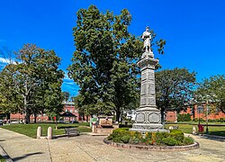
 Naugatuck Green | |
| Nickname: "Naugy" | |
| Coordinates: 41°29′23″N 73°03′05″W / 41.48972°N 73.05139°W | |
| Country | |
| U.S. state | |
| County | New Haven |
| Region | Naugatuck Valley |
| Incorporated | 1844 |
| Consolidated | 1895 |
| Government | |
| • Type | Mayor-burgesses |
| • Mayor | N. Warren "Pete" Hess |
| Area | |
| • Total | 16.39 sq mi (42.46 km2) |
| • Land | 16.30 sq mi (42.21 km2) |
| • Water | 0.10 sq mi (0.25 km2) |
| Elevation | 207 ft (63 m) |
| Population (2020) | |
| • Total | 31,519 |
| • Density | 1,908.58/sq mi (746.7/km2) |
| Time zone | UTC-5 (Eastern) |
| • Summer (DST) | UTC-4 (Eastern) |
| ZIP code | 06770 |
| Area codes | 203/475 |
| FIPS code | 09-49880 |
| GNIS feature ID | 0209191 |
| Website | www |
Naugatuck (/ˈnɔːɡətʌk/ NAW-gə-tuhk) is a consolidated borough and town in New Haven County, Connecticut, United States. The town, part of the Naugatuck Valley Planning Region, had a population of 31,519 as of the 2020 Census.[2]
The town spans both sides of the Naugatuck River just south of Waterbury and includes the communities of Union City on the east side of the river, Straitsville on the southeast (along Route 63), and Millville on the west (along Rubber Avenue).
- ^ "2019 U.S. Gazetteer Files". United States Census Bureau. Retrieved July 2, 2020.
- ^ "Census - Geography Profile: Naugatuck borough, Connecticut". United States Census Bureau. Retrieved December 18, 2021.


