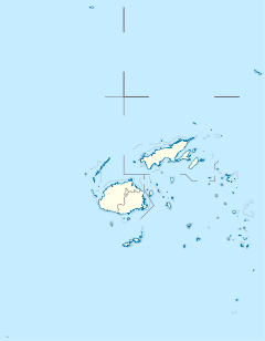
| Navua River | |
|---|---|
| Location | |
| Country | Fiji |
| Island | Viti Levu |
| Physical characteristics | |
| Mouth | |
• coordinates | 18°15′34″S 178°09′11″E / 18.259455288893083°S 178.1530899024746°E |
| Length | 65 km (40 mi) |
| Upper Navua Conservation Area | |
|---|---|
 | |
 | |
| Location | Viti Levu, Fiji |
| Coordinates | 18°07′28″S 177°56′52″E / 18.12444°S 177.94778°E |
| Area | 8.59 km2 (3.32 sq mi)[1] |
| Established | 1997 |
| Designated | 11 April 2006 |
| Reference no. | 1612[2] |
The Navua River is located in the island of Viti Levu in Fiji and has its source on the south east slope of Mount Gordon and flows for 65 kilometers to the south coast. It is noted for the rugged mountain country through which it flows.[3] In the late 19th century, a sugar mill was built on the banks of this river, and although the mill was shut down in 1923, the town of Navua stands on its site.
- ^ "Rivers Fiji (Upper Navua) | Protected Planet". www.protectedplanet.net. Retrieved 28 May 2017.
- ^ "Upper Navua Conservation Area". Ramsar Sites Information Service. Retrieved 25 April 2018.
- ^ Craigie, H. R. (1936). Handbook of Fiji. Suva, Fiji: Government printer. p. 3.
