Nawada District | |
|---|---|
 Phulwaria reservoir | |
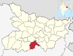
 Location of Nawada district in Bihar | |
| Country | |
| State | Bihar |
| Division | Magadh |
| Headquarters | Nawada |
| Government | |
| • Lok Sabha constituencies | Nawada |
| • Vidhan Sabha constituencies | Nawada, Hisua, Rajauli, Gobindpur & Warisaliganj. |
| Area | |
| • Total | 2,494 km2 (963 sq mi) |
| Population (2011)[1] | |
| • Total | 2,219,146 |
| • Density | 890/km2 (2,300/sq mi) |
| • Urban | 215,579 |
| Demographics | |
| • Literacy | 59.76% |
| • Sex ratio | 939 |
| Time zone | UTC+05:30 (IST) |
| Major highways | NH 20, NH 120 |
| Website | nawada |
Nawada district is one of the thirty-eight districts of the Indian state of Bihar. Nawada is its administrative headquarters. The district is the easternmost district of the Magadh division, one of the nine administrative divisions of Bihar. The area of the modern district was historically part of the Magadha, Shunga and Gupta empires. Koderma and Giridih districts of the state of Jharkhand lie on the southern border of the district; it also shares borders with the Gaya, Nalanda, Sheikhpura, and Jamui districts of Bihar.