Needles, California | |
|---|---|
|
Top: Needles Theatre (left), town sign (right); bottom: El Garcés. | |
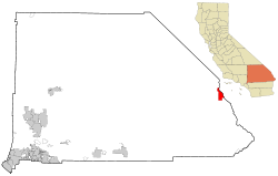
 Location in San Bernardino County and the state of California | |
| Coordinates: 34°50′53″N 114°36′51″W / 34.84806°N 114.61417°W[1] | |
| Country | |
| State | |
| County | San Bernardino County |
| Incorporated | October 30, 1913[2] |
| Named for | The Needles |
| Government | |
| • City manager | Patrick J. Martinez |
| Area | |
• Total | 31.08 sq mi (80.49 km2) |
| • Land | 30.58 sq mi (79.20 km2) |
| • Water | 0.50 sq mi (1.29 km2) 1.49% |
| Elevation | 495 ft (151 m) |
| Population | |
• Total | 4,959 |
| • Density | 162.73/sq mi (62.83/km2) |
| Time zone | UTC−8 (Pacific) |
| • Summer (DST) | UTC−7 (PDT) |
| ZIP Code | 92363 |
| Area codes | 442/760 |
| FIPS code | 06-50734 |
| GNIS feature IDs | 1652757, 2411220 |
| Website | www |
Needles is a city in eastern San Bernardino County, California, in the Mojave Desert region of Southern California. Situated on the western banks of the Colorado River, Needles is located near the California border with Arizona and Nevada.[6] The city is accessible via Interstate 40 and U.S. Route 95. The population was 4,959 at the 2020 census, up from 4,844 at the 2010 census.
- ^ a b "Needles". Geographic Names Information System. United States Geological Survey, United States Department of the Interior. Retrieved November 12, 2014.
- ^ "California Cities by Incorporation Date". California Association of Local Agency Formation Commissions. Archived from the original (Word) on November 3, 2014. Retrieved August 25, 2014.
- ^ "2019 U.S. Gazetteer Files". United States Census Bureau. Retrieved July 1, 2020.
- ^ "Explore Census Data".
- ^ Cite error: The named reference
USCensusEst2019CenPopScriptOnlyDirtyFixDoNotUsewas invoked but never defined (see the help page). - ^ "City of Needles Economic Development Strategic Plan" (PDF). April 22, 2014. Archived from the original (PDF) on June 10, 2017. Retrieved August 16, 2017.


