Neosho County | |
|---|---|
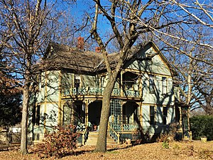
 James and Ella Truitt House in Chanute (2017) | |
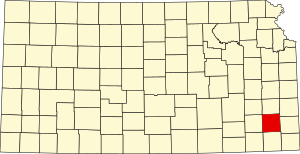
 Location within the U.S. state of Kansas | |
 Kansas's location within the U.S. | |
| Coordinates: 37°40′57″N 95°17′51″W / 37.6825°N 95.2975°W | |
| Country | |
| State | |
| Founded | June 3, 1861 |
| Named for | Neosho River |
| Seat | Erie |
| Largest city | Chanute |
| Area | |
• Total | 578 sq mi (1,500 km2) |
| • Land | 571 sq mi (1,480 km2) |
| • Water | 6.3 sq mi (16 km2) 1.1% |
| Population | |
• Total | 15,904 |
| • Density | 27.9/sq mi (10.8/km2) |
| Time zone | UTC−6 (Central) |
| • Summer (DST) | UTC−5 (CDT) |
| Congressional district | 2nd |
| Website | NeoshoCountyKS.org |
Neosho County is a county located in Southeast Kansas. Its county seat is Erie.[2] As of the 2020 census, the county population was 15,904.[1] The county was named for the Neosho River, which passes through the county.
- ^ a b "QuickFacts; Neosho County, Kansas; Population, Census, 2020 & 2010". United States Census Bureau. Archived from the original on August 18, 2021. Retrieved August 18, 2021.
- ^ "Find a County". National Association of Counties. Retrieved June 7, 2011.