| Nevado de Toluca | |
|---|---|
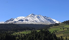
 Nevado de Toluca as seen from Lerma (southeast). | |
| Highest point | |
| Elevation | 4,680 m (15,350 ft)[1][2] |
| Prominence | 2,210 m (7,250 ft)[1][2] |
| Parent peak | Popocatépetl[2] |
| Isolation | 118.39 km (73.56 mi)[1][2] |
| Listing | |
| Coordinates | 19°06′06″N 99°46′03″W / 19.10167°N 99.76750°W[1] |
| Geography | |
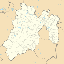
| Location | Texcaltitlán, México, Mexico |
| Geology | |
| Mountain type | Stratovolcano |
| Volcanic arc/belt | Trans-Mexican Volcanic Belt |
| Last eruption | 1350 BCE (?) |
| Climbing | |
| Easiest route | road, hiking trail |
Nevado de Toluca (Spanish: [neˈβaðo ðe toˈluka] ) is a stratovolcano in central Mexico, located about 80 kilometres (50 mi) west of Mexico City near the city of Toluca. It is the fourth highest of Mexico's peaks, after Pico de Orizaba, Popocatépetl and Iztaccíhuatl. The volcano and the area around it is now a national park.
- ^ a b c d "Mexico Ultras" Peaklist.org. Retrieved 2012-01-29.
- ^ a b c d "Nevado de Toluca, Mexico" Peakbagger.com. Retrieved 2012-01-29.

