Newington, Virginia | |
|---|---|
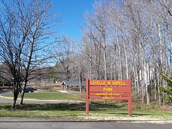
 Levelle W. Dupell Park in 2018 | |
 Location of Newington in Fairfax County, Virginia | |
| Coordinates: 38°44′7″N 77°12′13″W / 38.73528°N 77.20361°W | |
| Country | United States |
| State | Virginia |
| County | Fairfax |
| Area | |
| • Total | 4.6 sq mi (11.9 km2) |
| • Land | 4.6 sq mi (11.8 km2) |
| • Water | 0.04 sq mi (0.1 km2) |
| Elevation | 108 ft (33 m) |
| Population (2020) | |
| • Total | 13,223 |
| • Density | 2,844/sq mi (1,098.1/km2) |
| Time zone | UTC−5 (Eastern (EST)) |
| • Summer (DST) | UTC−4 (EDT) |
| ZIP code | 22153 |
| Area code | 703 |
| FIPS code | 51-55752[1] |
| GNIS feature ID | 1495074[2] |
Newington is a census-designated place (CDP) in Fairfax County, Virginia, United States. As of the 2020 census, the population was 13,223.[3] The population was 12,943 at the 2010 census.[4] The 2010 census showed a significant decrease after half the population was split off to the newly created Newington Forest CDP.
While the ZIP code for Newington is 22122, this is only for delivery points within the post office itself. Homes and businesses in the CDP have Springfield or Lorton street addresses.
- ^ "U.S. Census website". United States Census Bureau. Retrieved January 31, 2008.
- ^ "US Board on Geographic Names". United States Geological Survey. October 25, 2007. Retrieved January 31, 2008.
- ^ "Newington CDP, Virginia". data.census.gov. Retrieved January 26, 2024.
- ^ "Geographic Identifiers: 2010 Demographic Profile Data (G001): Newington CDP, Virginia". U.S. Census Bureau, American Factfinder. Retrieved October 14, 2016.[dead link]


